
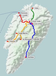
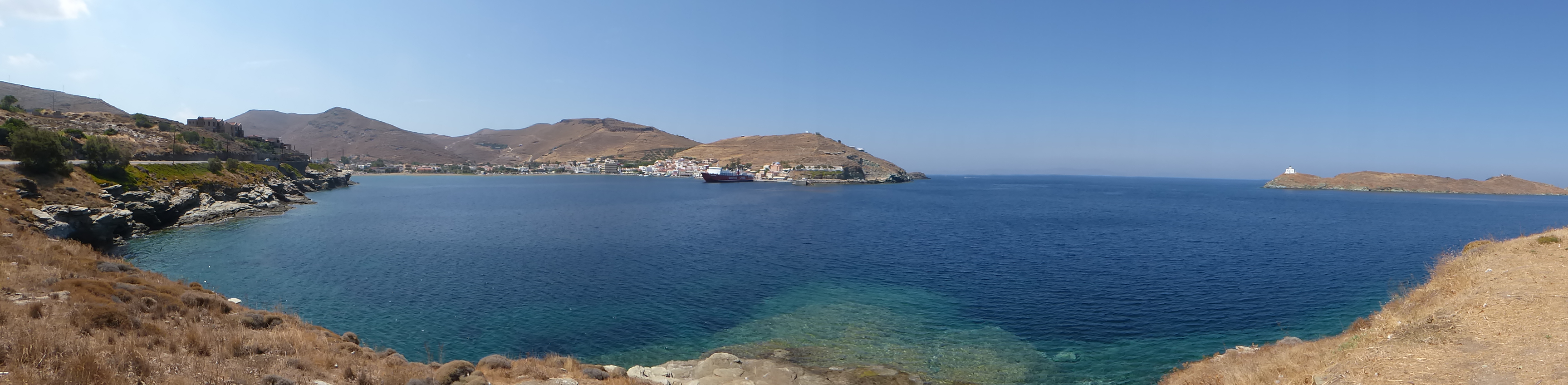
- Keos Harbour (Livadhi) – March 27 1884
- Barba Manthos
- Keos – A Well-known Place
- Katsonis of Keos
- The Acorn Trade – Oaks in Keos
- Ancient Koressia – March 27 1884
- The Paths of Keos
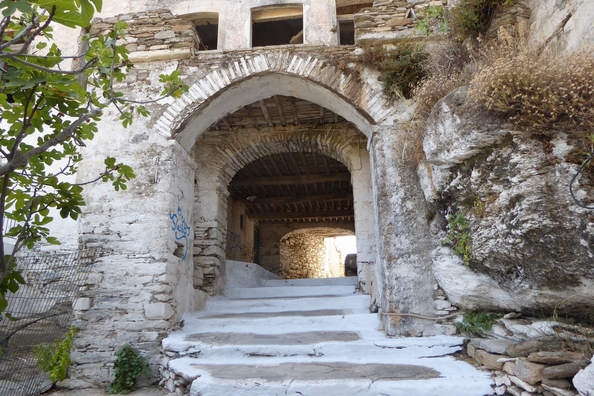
- Chora – March 27 1884
- Ancient Ioulis – March 27 1884
- Hellenika – March 28 1884
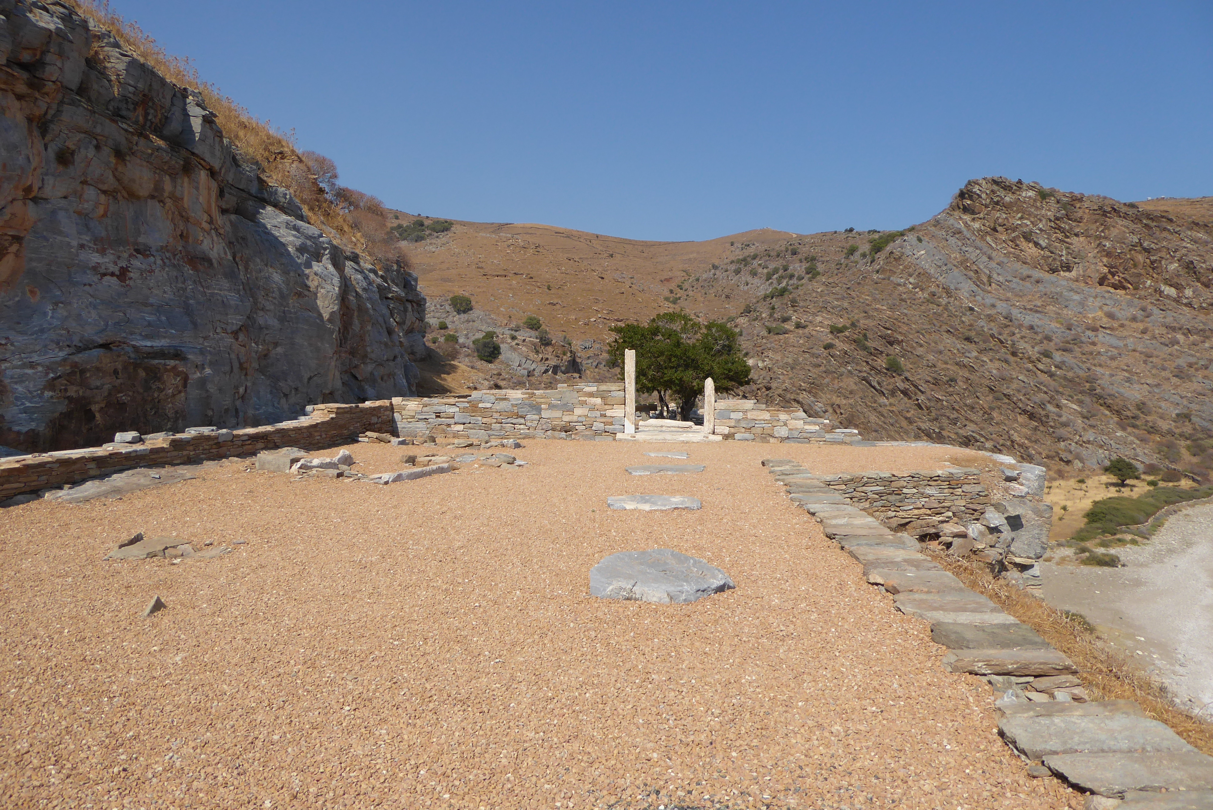
- Ancient Karthaia – March 28 1884
- The Lion of Keos
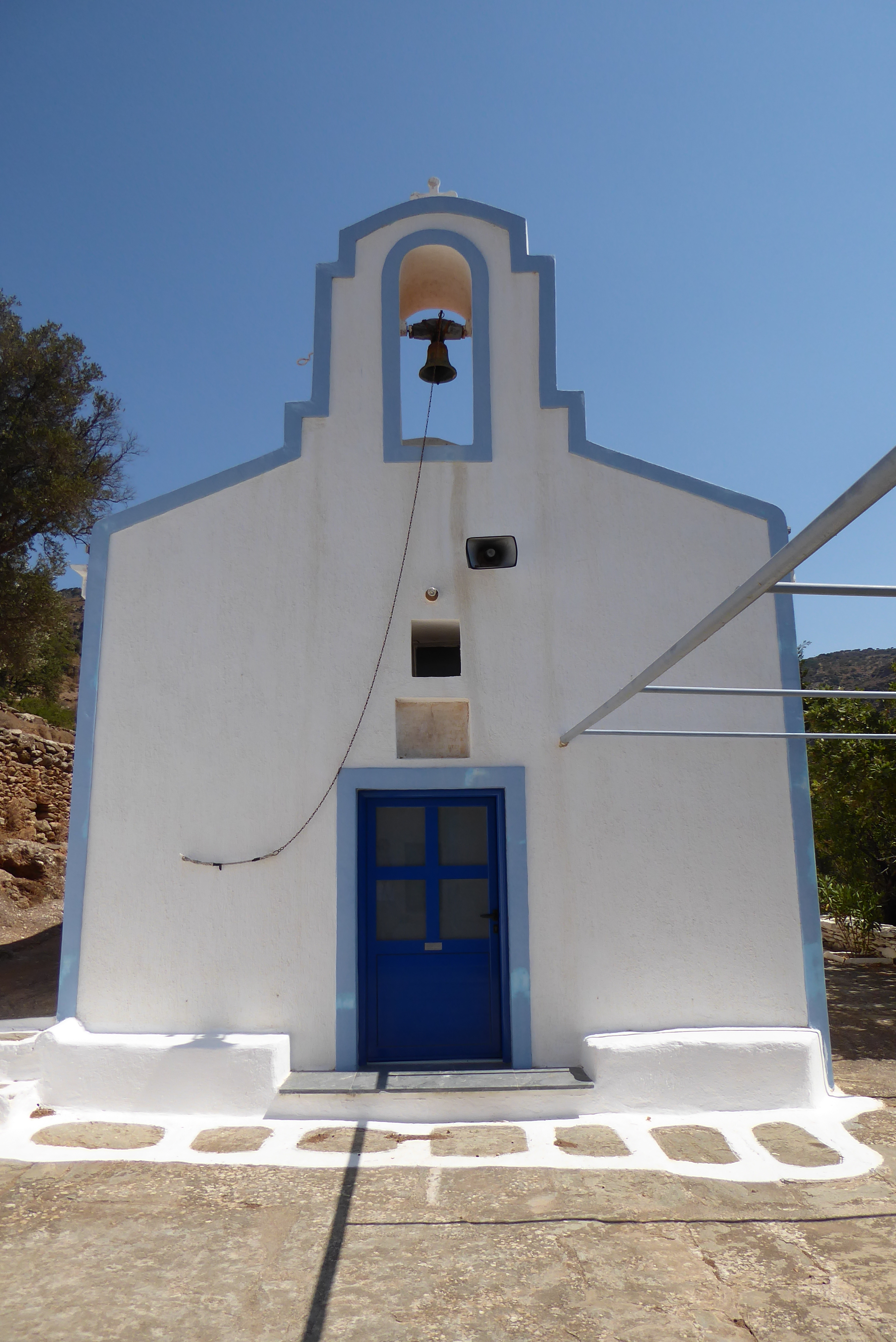
- St. Anarguris – March 29 1884
- The Tower of Hagia Marina – March 29 1884
- Ancient Poiessa – March 29 1884
- Otzia – March 31 1884
- Adieu to Keos
- Join the adventure
Keos Harbour (Livadhi) – March 27 1884
The Bents arrived in Keos aboard a Peloponese caïque carrying lime that they’d managed to negotiate a crossing on from Kythnos after the cowardly captain of another boat had refused to take them.
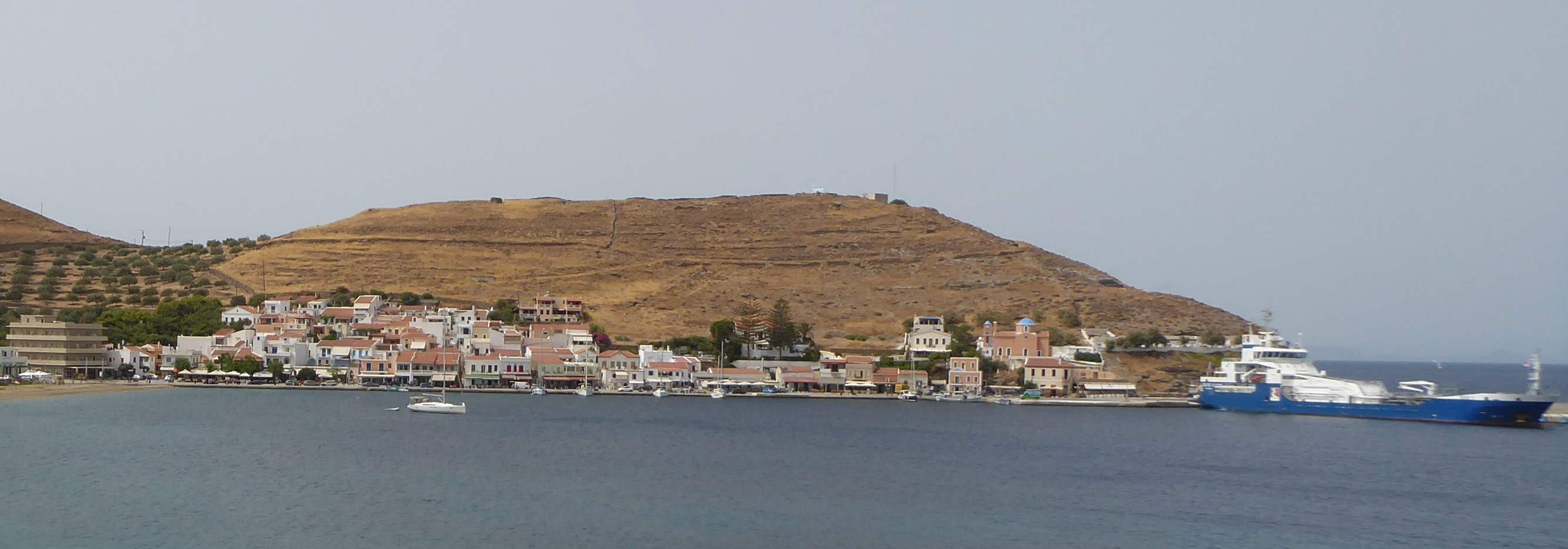
Their original intention was to land in the south east of the island at Poles Bay where ancient Karthaia is located but, instead, they were delivered to the port of Livadhi, or Korissia as it’s also known today.
It is blessed with a fine harbour, and is the nearest of the Cyclades to Athens . . . a busy little place, and larger than most island ports
The caïque that brought them dropped them and immediately departed without paying any harbour dues. The Bents didn’t know the captain’s name or exactly where the boat was from in the Peloponese.
The Custom House officer sent for us before we had been ten minutes on shore, and it was with some trepidation that we went to his house . . . and who was to know from what country we had come?
In the event, the officer was merely affording them the customary Greek hospitality and asked them to join him for his midday meal.
Barba Manthos
Almost immediately on arrival at Livadhi the Bents were introduced to the man who would be their guide and companion for the duration of their stay, Barba Manthos.
Scarcely had we landed, and realised that we were on the island, than we were introduced to a pleasant old man, a celebrity in Keos, for he knows every inch thereof: he rejoices in the name of Barba Manthos
Barba Manthos was key to the Bents’ itinerary and understanding of the archaeology and customs of Keos. His knowledge of archaeology, history and mythology reveals him to be more than just an old gent with a little local knowledge. Gerard Brisch, editor of Mabel’s diaries names him as Konstantinos Manthos and describes him as ‘an autodidact, local historian and collector‘ but does not reveal the source of this information. It would be nice to track him down further lest he be consigned to obscurity. However, obscurity is unlikely since it seems that he is commemorated on the memorial in the small park at the harbour of Korissia; under the title ‘Important Keans of the 19th and 20th Centuries – Scientific Authors’ is an entry for Konstantinos Manthos who is listed as an archaeologist.

This must surely be our Barba Manthos, or possibly Barba’s son, inspired by his father’s passion for archaeology. Knowledgeable locals tell us that Manthos is not a common name in Kea and, in fact, there are only 6 or so names that are found in old-established families in the island.
More research would prove or refute this hypothesis and might lead us to Barba Manthos’ living descendants. Please blog us if you unearth more information.
The Bents’ appreciation of Barba Manthos is summed up in Theodore’s uncharacteristically warm parting remarks as they leave Kea, and the Cyclades, for good:
. . . and (we) bid farewell to Barba Manthos, whose intelligent guidance for five days had contributed so much to the pleasure of our stay in Keos.
Keos – A Well-known Place
When the Piraeus was nothing but a heap of ruins all the Turkish Government ships, and merchant ships which had to do with Greece, harboured in Keos; and when a ship was wanted at Athens they lighted a beacon on the spurs of Hymettus, and she came up the Saronic Gulf.
Katsonis of Keos
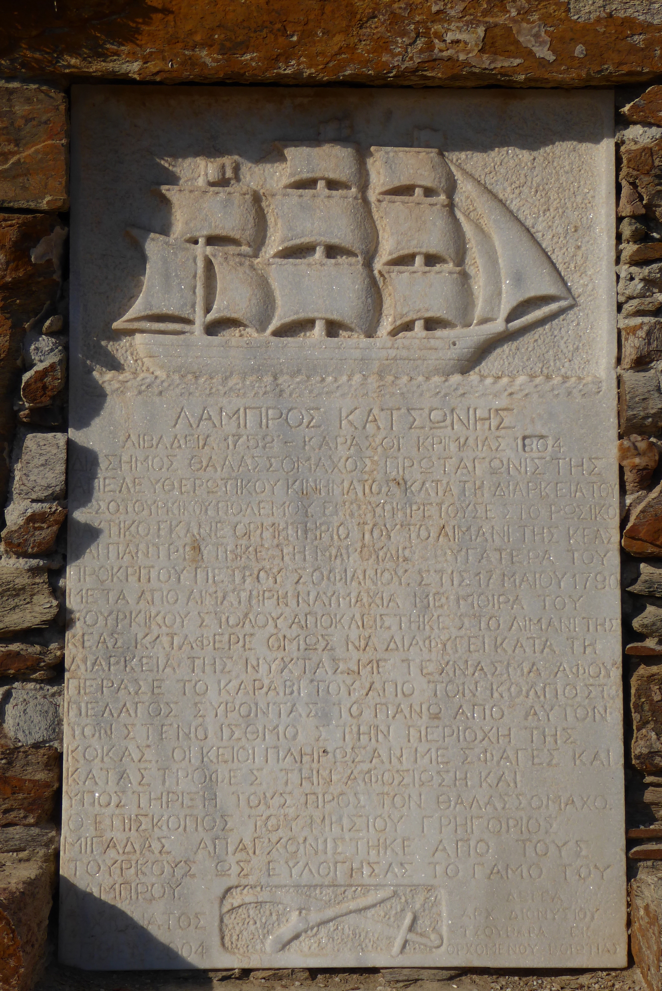
Keos was the emporium of the Cyclades. Catherine of Russia recognised its importance when she put Katzoni of Keos at the head of the Greek corsairs who ravaged Turkey.
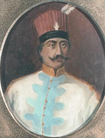
Lambros Katsonis is something of a folk hero in Greece and particularly in Kea, where his statue stands in the small park at the port of Korissia.
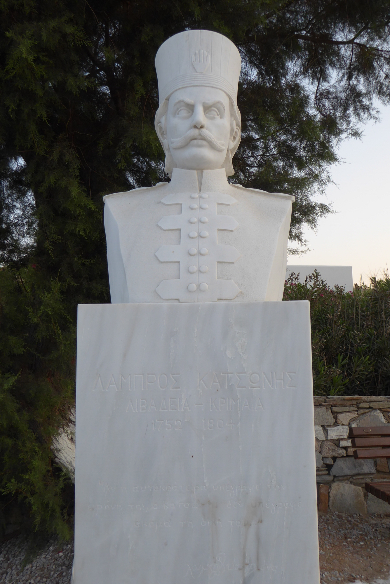
He served with the Russian Navy during the Russo-Turkish war of 1787-1792 fighting against the Turks from his bases in the Mediterranean, including the bay of Aghios Nikolaos where Korissia (Livadhi) is situated.
One of Katsonis’ corsairs’ battles is depicted in a painting on display at the National Maritime Museum in Greenwich, London, entitled ‘Turks Attacking Greek Corsairs‘, although, in reality, the names of the protagonists should probably be reversed.
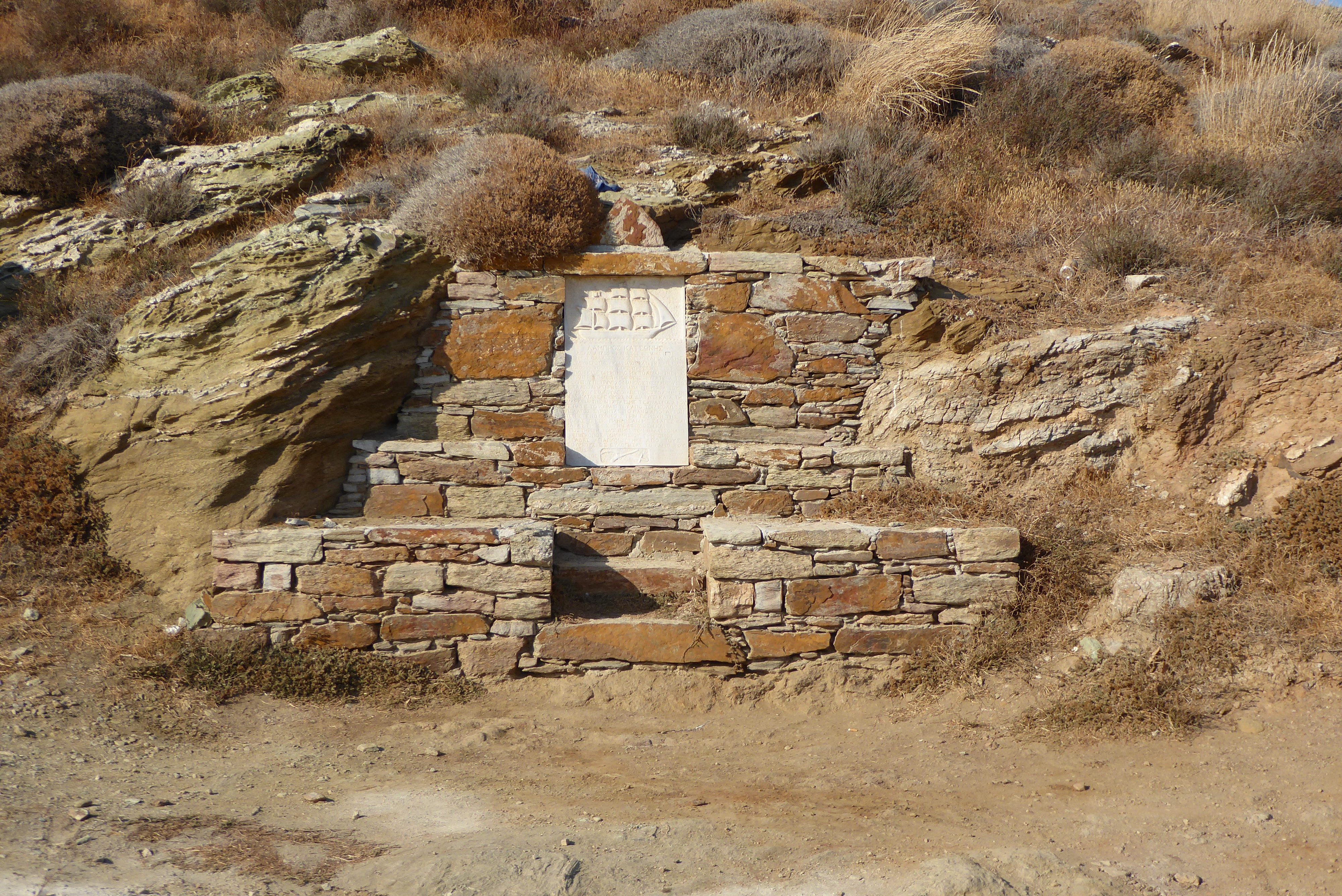
Katsonis became a legend after his daring escape from the Turks in 1789 when the Turkish fleet blockaded the entrance to Aghios Nikolaos Bay, trapping Katsonis inside. The story goes that, in the dead of night, he and his men hauled his ship across the narrow isthmus of Kokka, close to where the current lighthouse stands, and made their escape into the open sea while the Turks still slept.

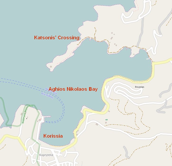
The point where they crossed is now called ‘The Katsonis’ Crossing’ and the stretch of sea is known as the ‘Lambros Katsonis Strait’. In 2004, the Kean sculptor Giorgos Hianatos erected a marble plaque commemorating the event and Katsonis’ rôle in the struggle against the Turks.
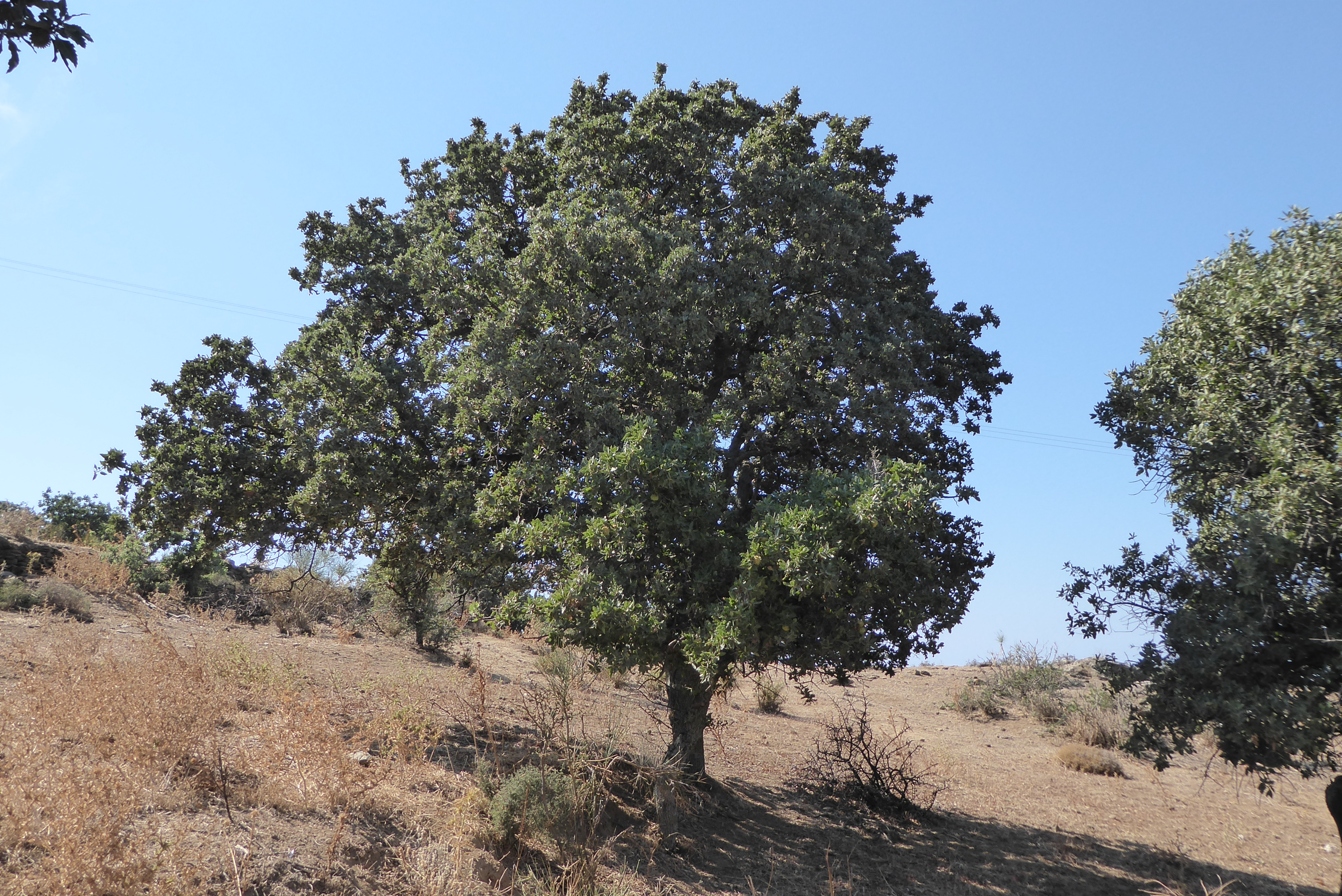
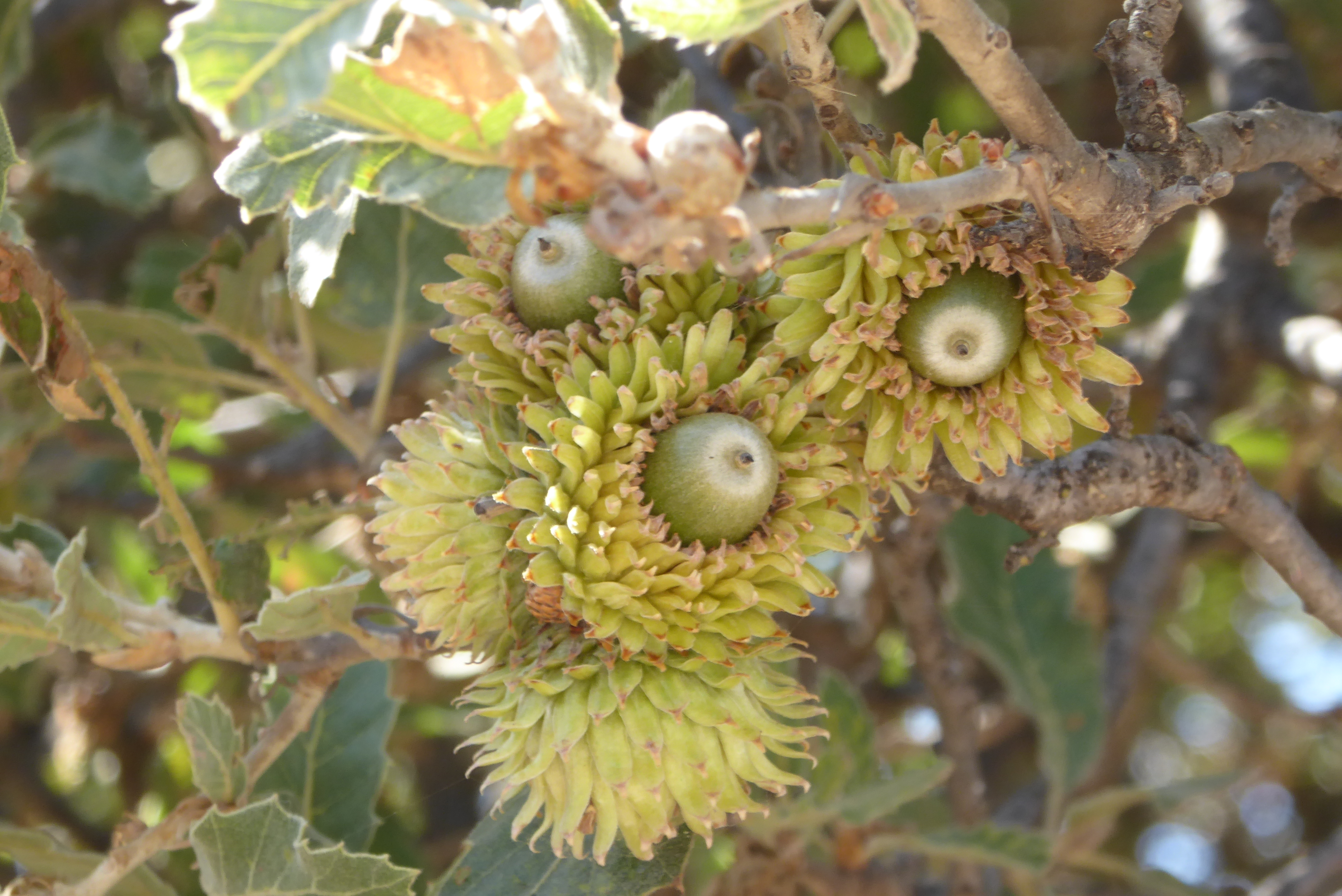
The Acorn Trade – Oaks in Keos
From times of antiquity until the mid 20th Century, acorns were key to the economy of the island.
When Tournefort visited in 1701 the acorn trade was the major export industry and he describes the oak tree and its acorns in his book A Voyage into the Levant. The Venetian ship he left the island on was carrying a cargo of acorns.
Theodore writes:
The port of Keos, Livadhi by name, is a busy little place . . . the whole place was full of sacks of acorns when we arrived, so that we were made acquainted at once with the staple trade of the island, which boasts of a million and a half oak trees growing over all but the northern slopes

The acorns are huge things, as big as eggs, astonishing to our eyes; but it is the cup only that they export, the acorns are, as with us, eaten by the pigs
From the mid-1960s, the acorn industry went into almost terminal decline and the only remnants of the millennia old industry were the hundreds of thousands of oak trees gracing the hillsides and valleys of the island.
But the industry is sprouting again, driven by a determined local lady Marcie Mayer, supported by a European Union initiative. You can read about Marcie’s work and view her video. You might even consider volunteering to help her bring in the acorn harvest!
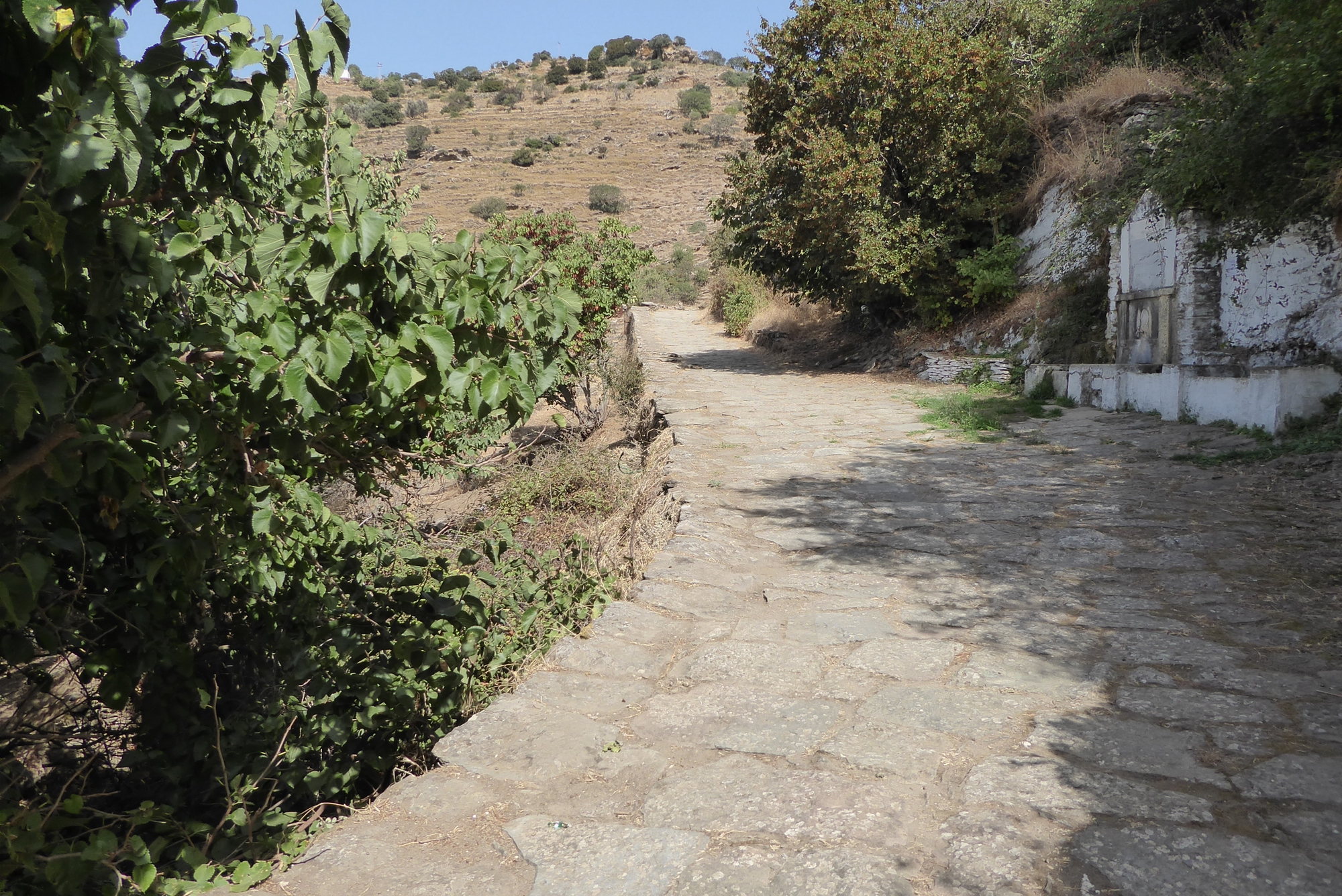
The Paths of Keos
. . . no ascent (in the Cyclades) is so good as the one which joins the town of Keos to its port . . . along a well-paved road which is built on the ancient foundation . . . Keos is full of traces of ancient roadways

The excellent website www.cycladen.be describes walking/trekking trails in Kea and throughout the Cyclades.
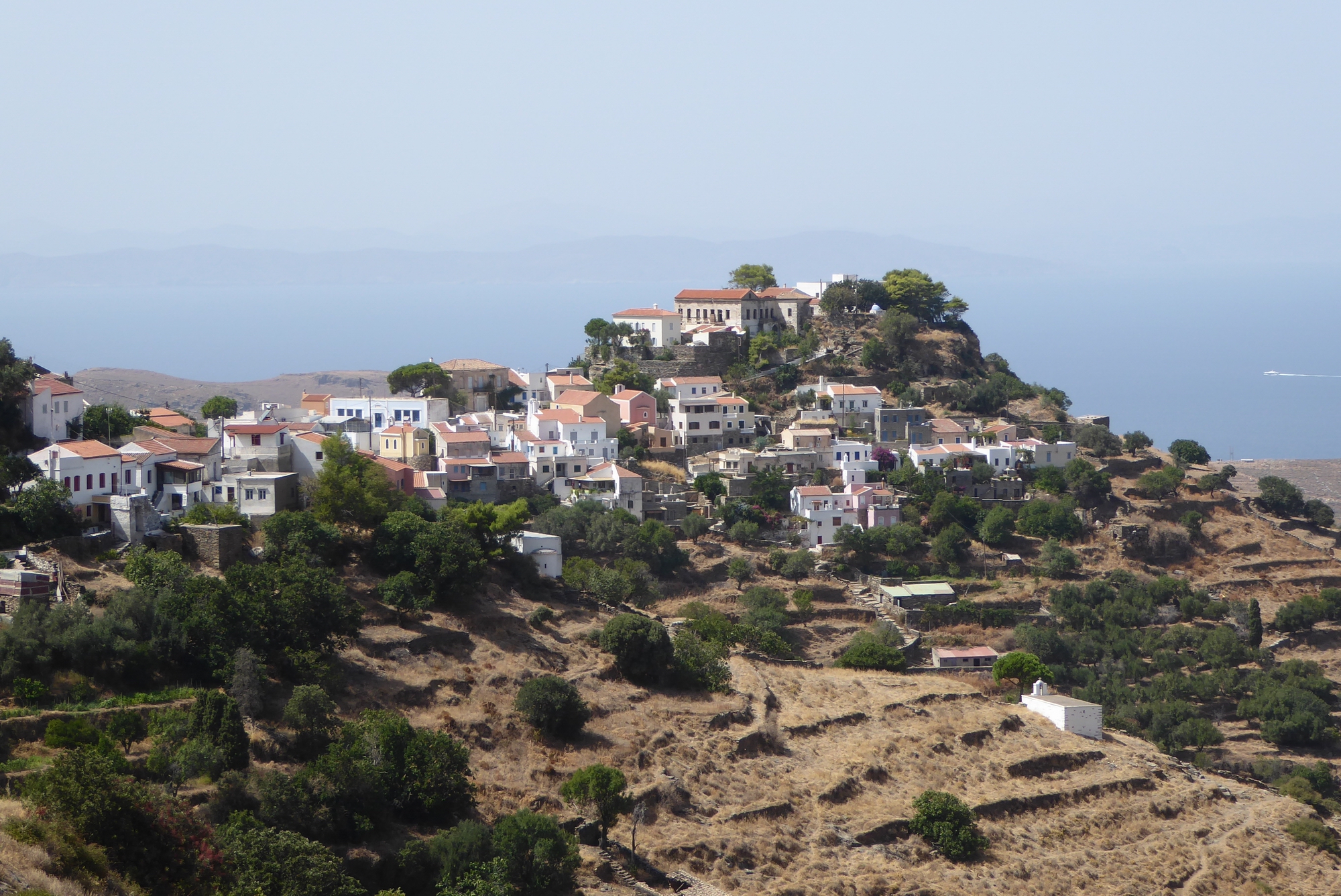
Chora – March 27 1884
After arriving at the port of Livadhi (Korissia) and visiting the site of Ancient Koressia, Theodore and Mabel headed for the Chora of Keos where they were to stay for the duration of their visit.

After winding up the hillside for about half an hour the curious town of Keos burst on our view: it is like a white and yellow plaister on the side of the lofty mountain which encircles it; the houses climbing one above another like the steps of a gigantic ladder.

On a spur which sticks out from the mountain in the middle of the town, and which is connected with the mountain by a col covered with cottages, are built some of the finest houses; and here was the ancient Greek town of Ioulis as well as the mediaeval town . . . The outline of the white and yellow town against the blue sea and distant mountains is perfectly enchanting
The Bents were taken up to the eparch’s house in Chora by a muleteer named Petros. While being treated to coffee and jam, the eparch and the demarch arranged that they should stay in Petros’ house while in Keos. Mabel’s diary amusingly describes its location.
. . . finally we got into the house of our muleteer, Petro, a very long way through the piggy streets from the Eparch’s
Ancient Ioulis – March 27 1884
Ioulis, on the ruins of which the modern town is built, contains considerable remains of antiquity. Round the spur of the hill which rises up at the south end of the town, are massive Hellenic walls
It’s difficult to find many of the remains of Ancient Ioulis mentioned by Theodore. If you find any during your visit, please blog your findings and photos so we can include them here.
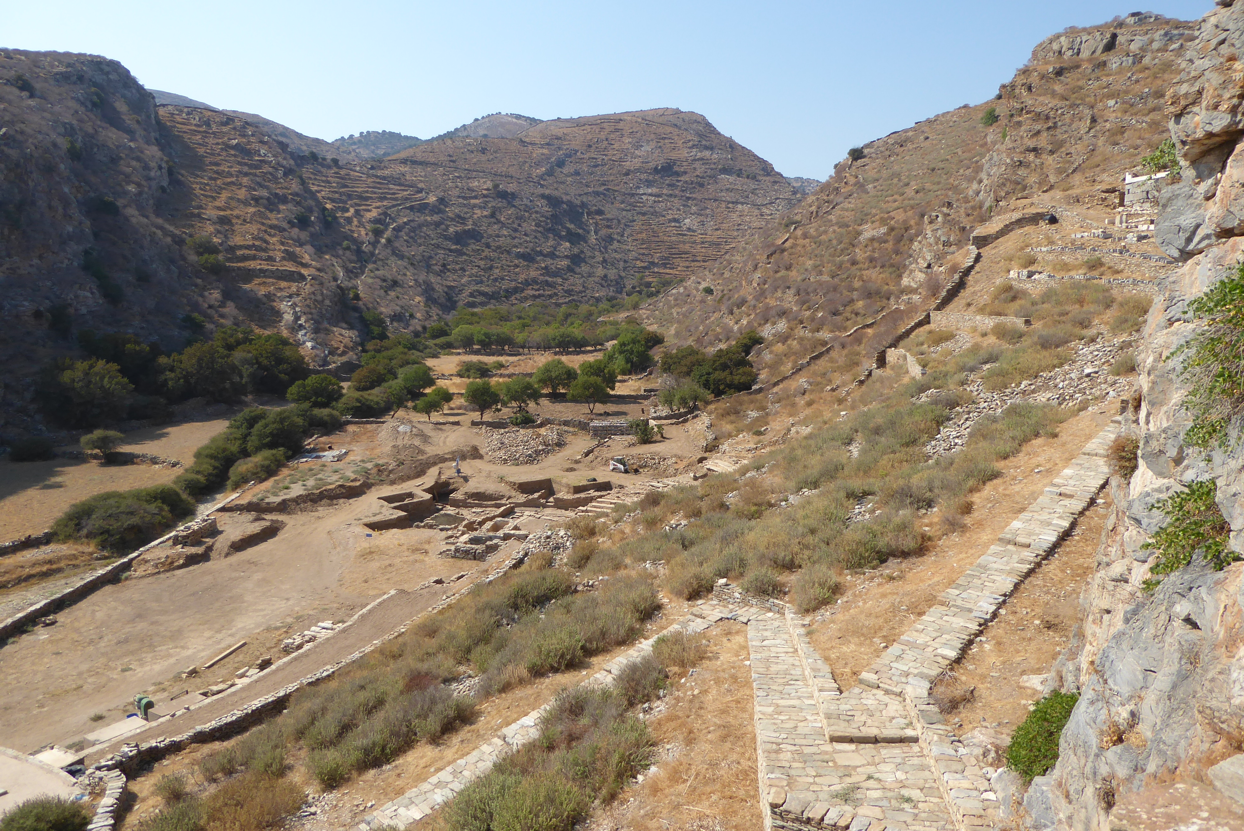
Ancient Karthaia – March 28 1884
On their first full day in Keos, Mabel stayed at the house in Chora attempting to rest, without much success according to her diary.
Meanwhile, Theodore and Manthaios went with Barba Manthos by mule to the site of Ancient Karthaia returning via the village of Hellenika.
Try the interactive, Google satellite image of Ancient Karthaia. Zoom in and out and click on the marker pins to locate the buildings on the site.
As you descend the hill you traverse the old road, which led from Ioulis to Karthaia
The city . . . in point of choice of site is without a rival; the spot is sheltered from every breeze except the south by a lofty semicircle of mountains, and all around the vegetation is most luxuriant — magnificent oak trees and yellow spurge in flower, almost shrubs in the luxuriance of their growth
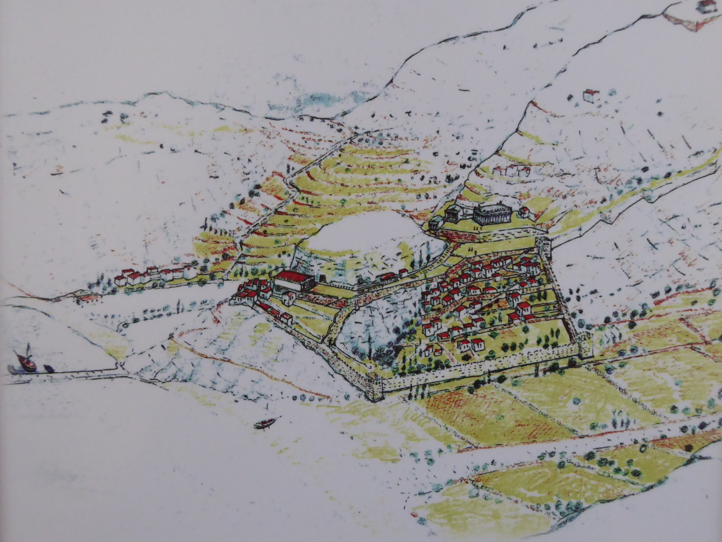

. . . the whole site of the town remains uncultivated, and is only used as a pasturage for flocks by a shepherd, who has a little ‘stable’ down in the valley, and who refreshed us with some excellent wine. This shepherd rents the whole of the land on which the city stood, and more besides, for the annual sum of two pounds . . . A few years ago in the western valley an inscription was discovered proving the existence of a temple of Aesculapius . . . Close to this spot is the theatre of Karthaia, very much damaged, but the form of it still distinct
It was a gloriously warm day; not a breath of wind disturbed us as we lunched on the shore

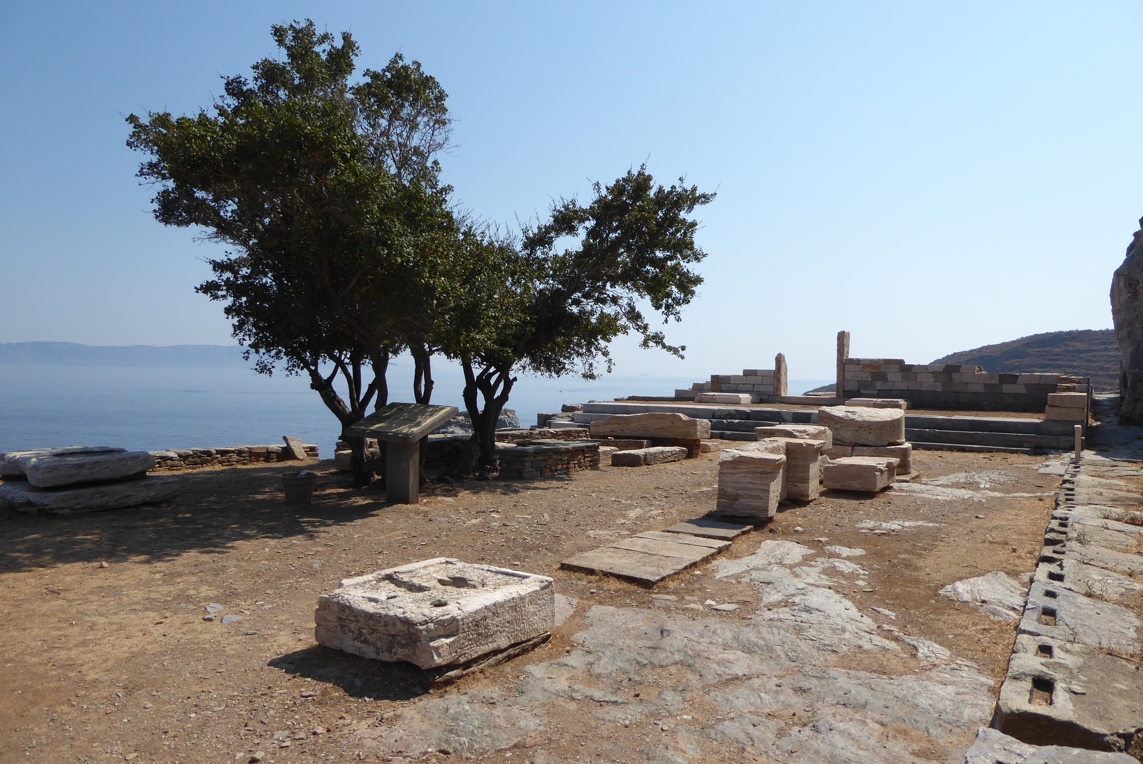
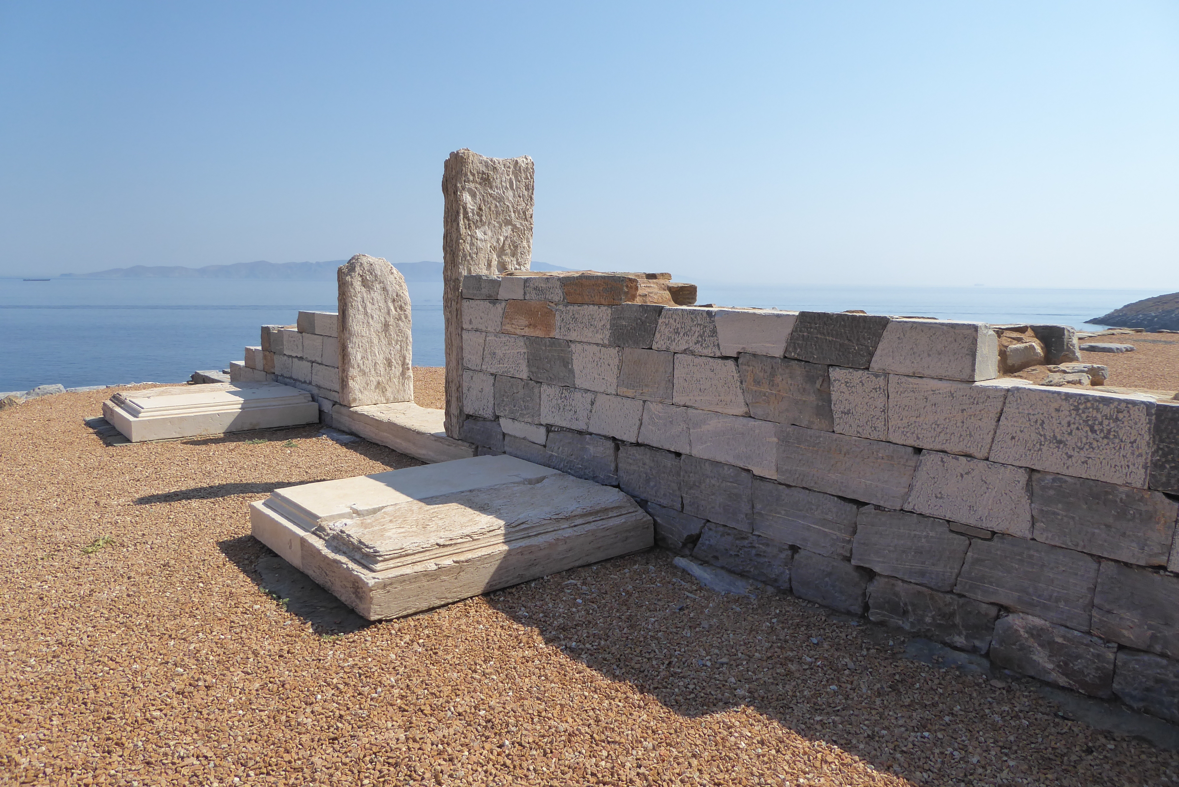
. . . a long spur runs down a valley surrounded on the north, east, and west by lofty mountains to the sea, dividing it into two almost equal portions; the one on the east was devoted to the cemetery, both Greek and Roman, many of the graves of which had been destroyed by the encroaching sea. In the western part were some of the chief public buildings. The town and the acropolis are on the spur.


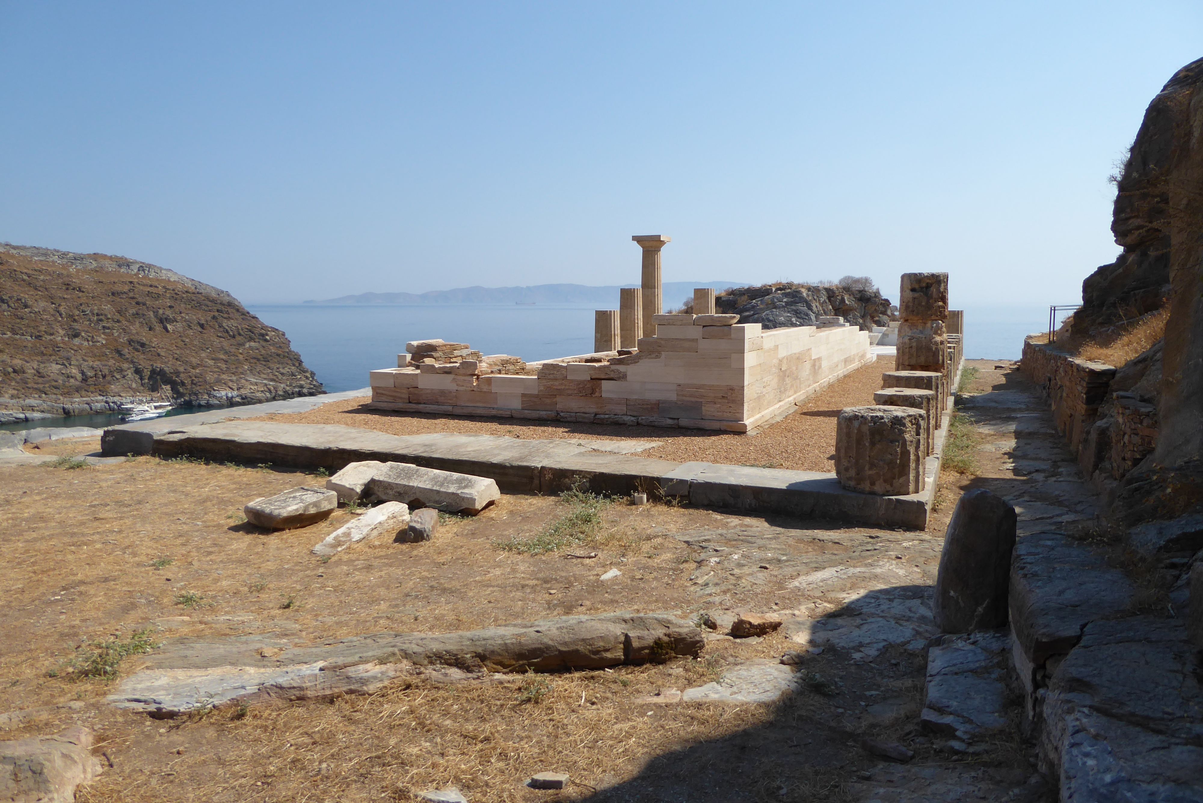
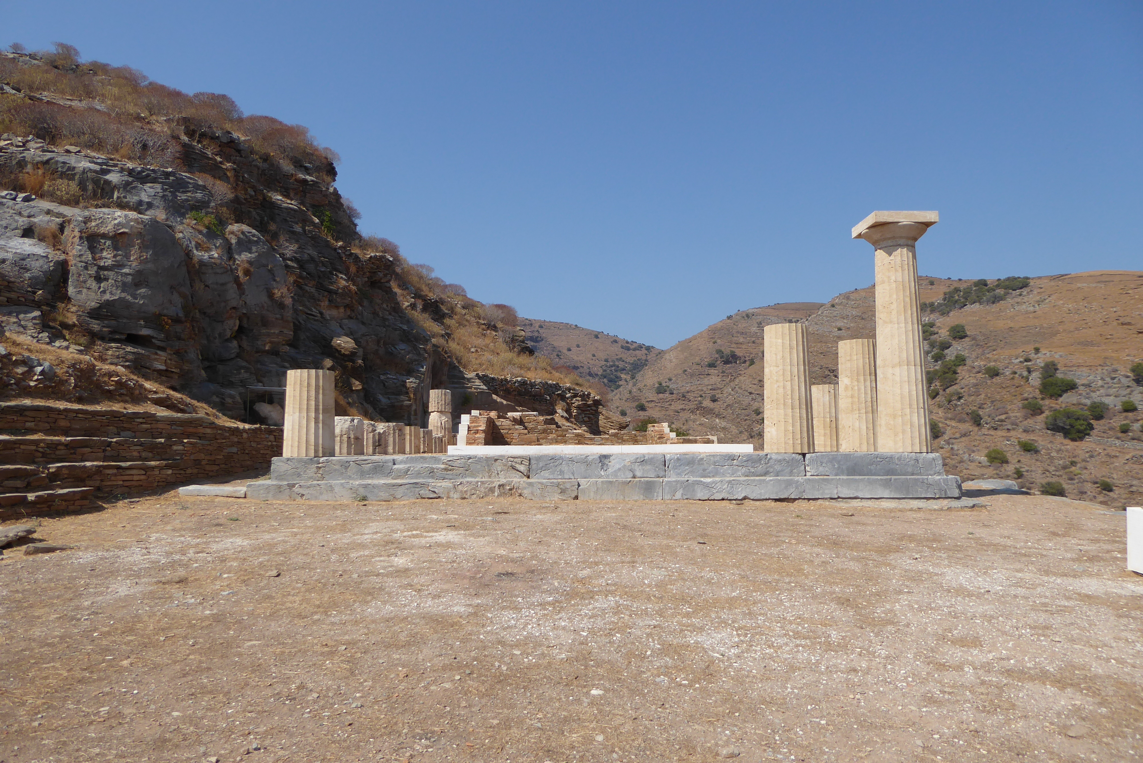
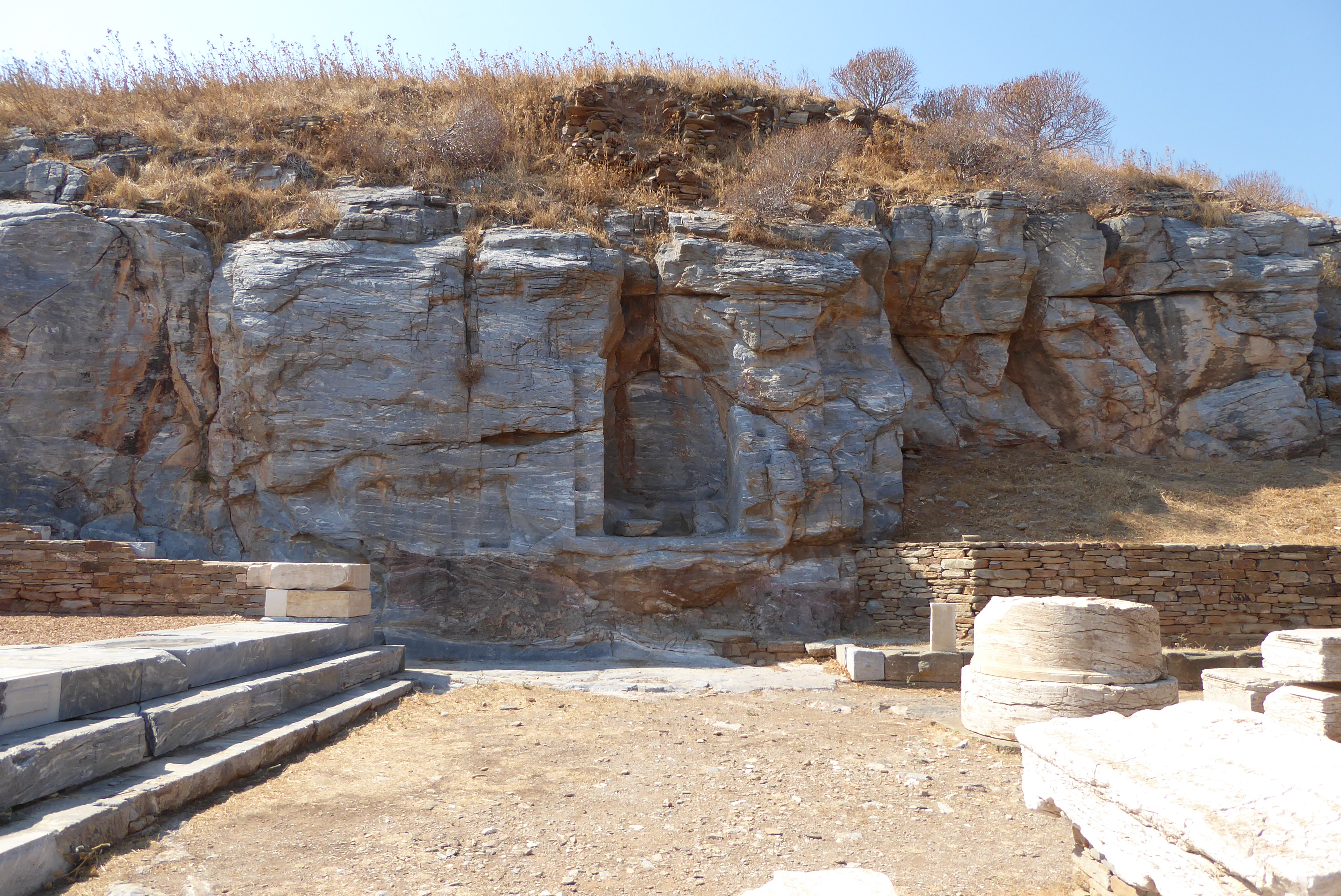
At the end of the spur leading into the sea Bronsted identified by an inscription the celebrated temple of Apollo of Karthaia, and in a niche of the rock overlooking the sea was found a portion of the statue of that god, which he removed. Just above this temple must have been the platform where Simonides gave his music lesson
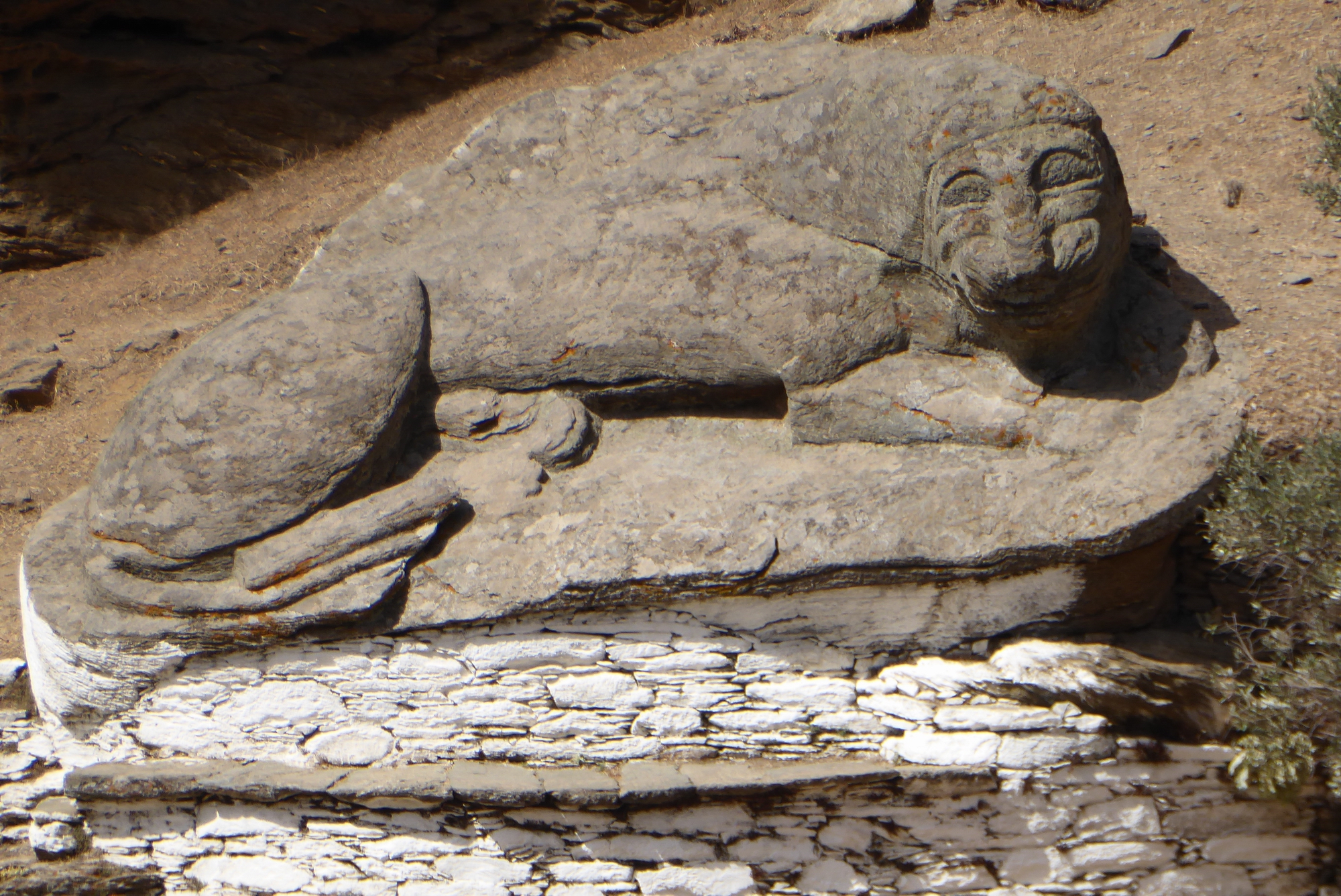
The Lion of Keos
Close to their town the Keotes have one of the most charming promenades in the world — a broadish level walk skirting the hillside and leading to the celebrated lion
The lion of Keos is the most interesting sight on the island. It reposes on the hillside, propped up by stones to prevent its further slipping. It is made of grey granite, and from nose to tail is nine yards and a half long. It is in an attitude of repose, and though much worn by age the features are all distinct — eyes, mouth, and mane.

St. Anarguris – March 29 1884
Theodore relates the story about the patron saint of flocks and herds and the customs attached to the saint and his church at ‘sto makrinó’ which means ‘in the distance’. Interestingly, the name was not just a description of the location but was, and remains, the actual place name.
St. Anarguris, whose little white church is at the distant hamlet known as sto makrinó
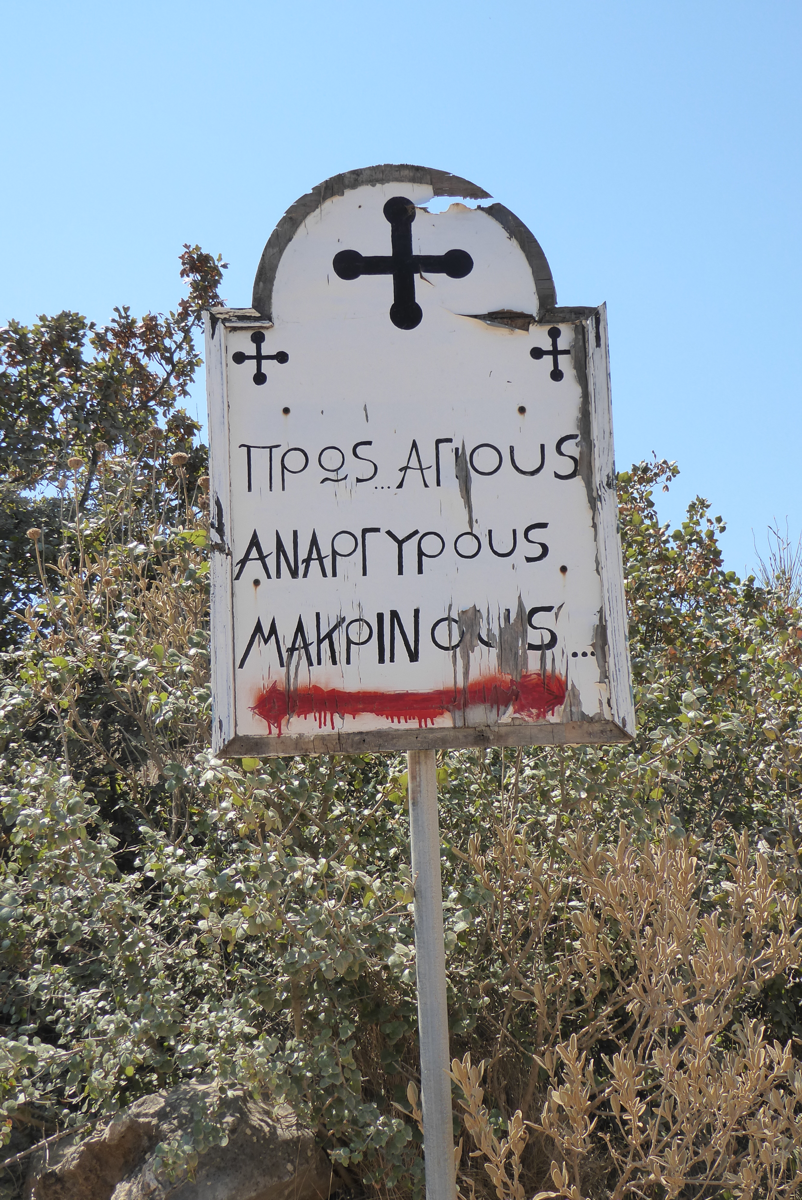
The church is signposted off a track that leads off the road from Chora to Pisses, 4.9 kms from Chora, immediately past a row of modern holiday apartments. The track descends down into the ravine for 1.9 kms before reaching the church.
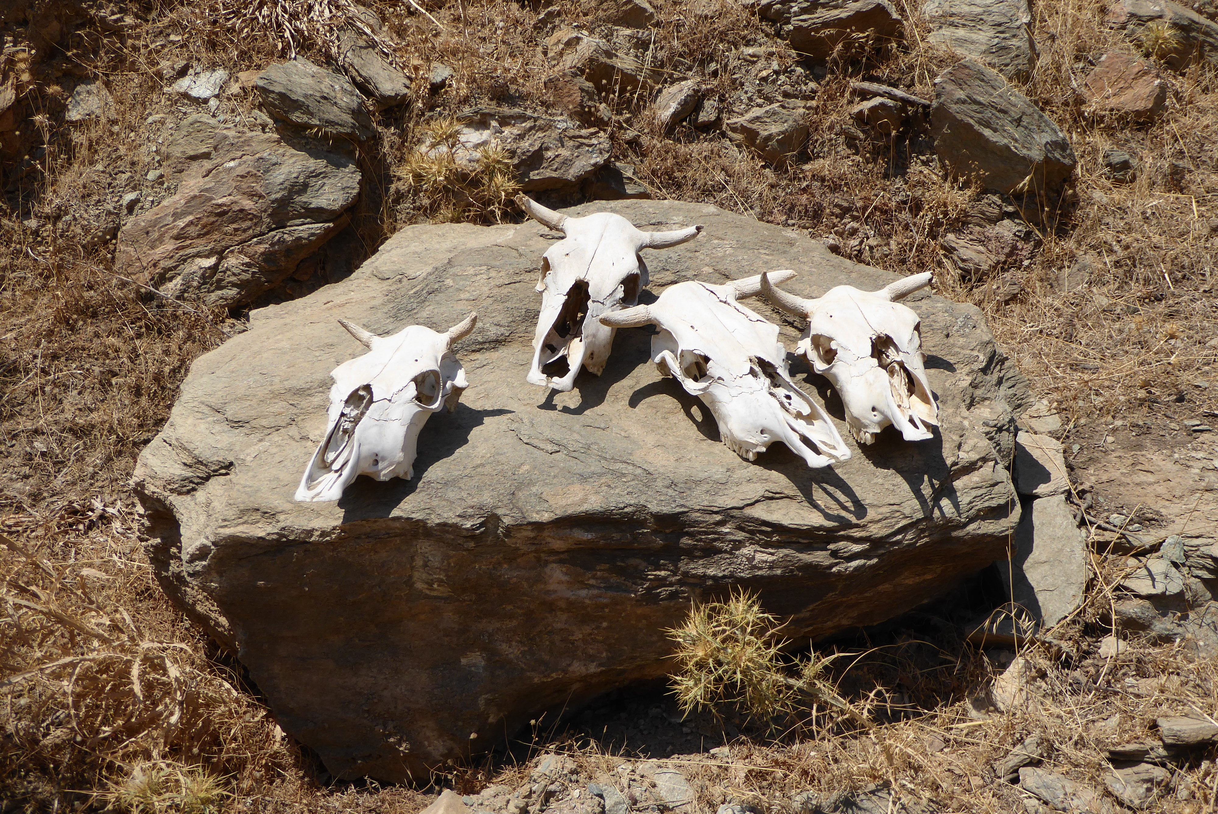
. . . on July 1, the day on which they celebrate the feast of this saint, numbers of aged oxen may be seen on the road to this church, where they are slaughtered on the threshold, and the flesh distributed amongst the poor
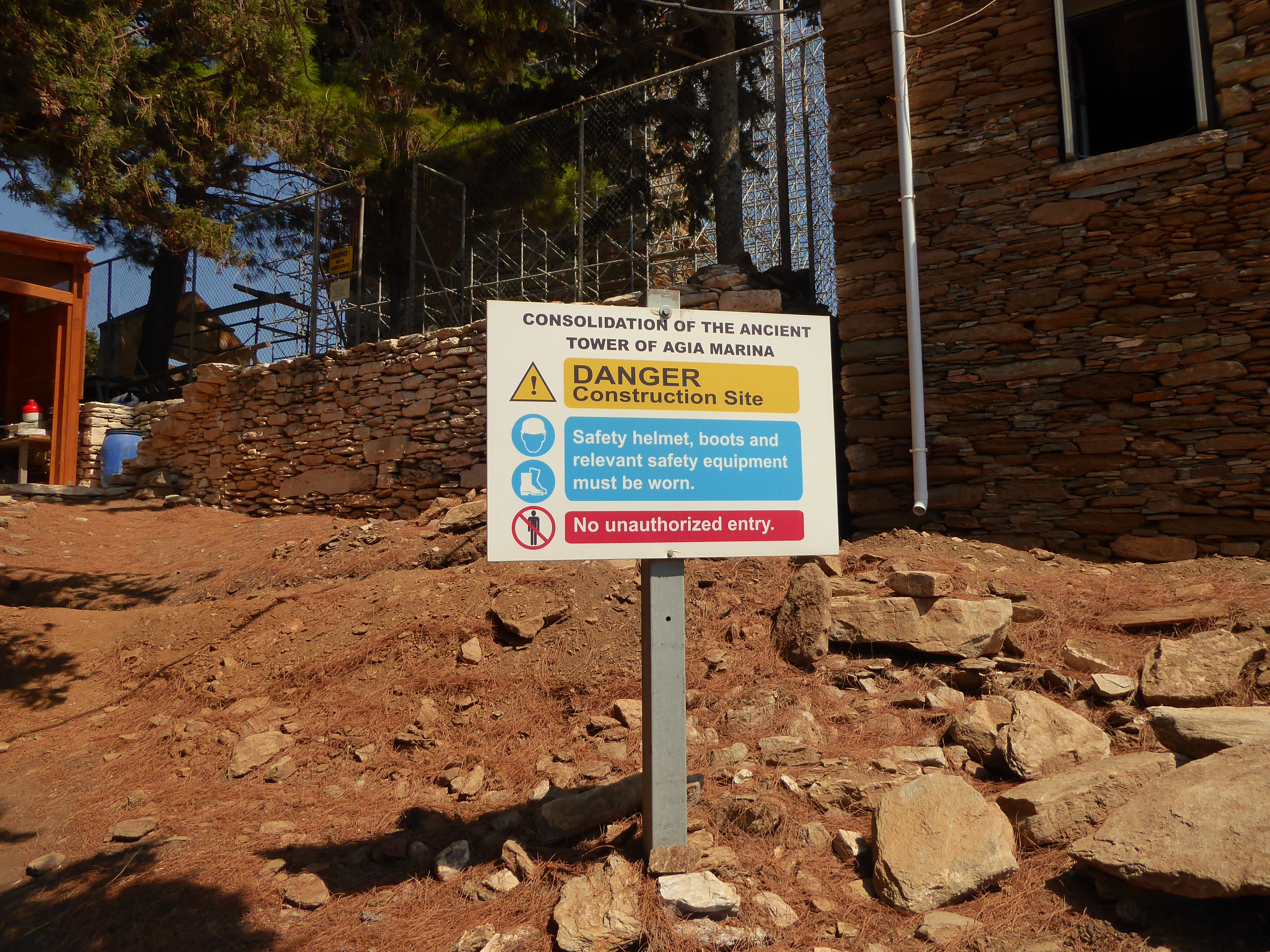
The Tower of Hagia Marina – March 29 1884
The Bents visited the tower of Agia Marina on their penultimate day in the Cyclades en-route to visit the ancient city of Poiessa (Pisses).
It has taken a rich yellow colour with age, and, on account of its being useful to the monks, it has been preserved from destruction, and is still in a very fair state of preservation.
Mabel’s diary tells us that she and Theodore, together with Manthaios and Barba Manthos, rode for 2 hours to get to the tower. Theodore and Barba continued on to explore Poiessa and returned 3 hours later in time for lunch.
Manthaios was left with me and to prepare luncheon. I wandered about for half the time and sat among the oleanders of a riverbed but at last an old man of 80 came and made me go to the tower of which he is the guardian . . . I saw them making mesethra by pouring fresh milk into boiling whey and had a plateful hot. We all, including Petros our handsome host and muleteer, sat down at a very low table and had a very good luncheon with limited implements, which I’m sure I would not have enjoyed a year ago.
In almost a parallel to this account, the present author, on his visit to the tower, tells the story of how he was also regaled with a sumptuous impromptu feast, laid on by the group of archaeologists working on restoring the tower. Is there some spirit of filoxenia that pervades Agia Marina?
The exertion of Theodore’s travels ensured that he always had a healthy appetite, as witnessed in the wonderfully phrased account of his visit to the marble quarries of Paros:
The descent . . . and the subsequent climb were productive of an appetite of considerable dimensions
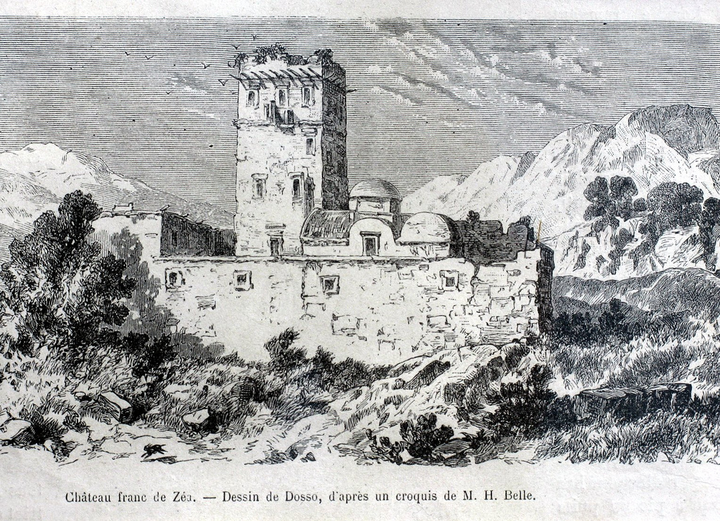
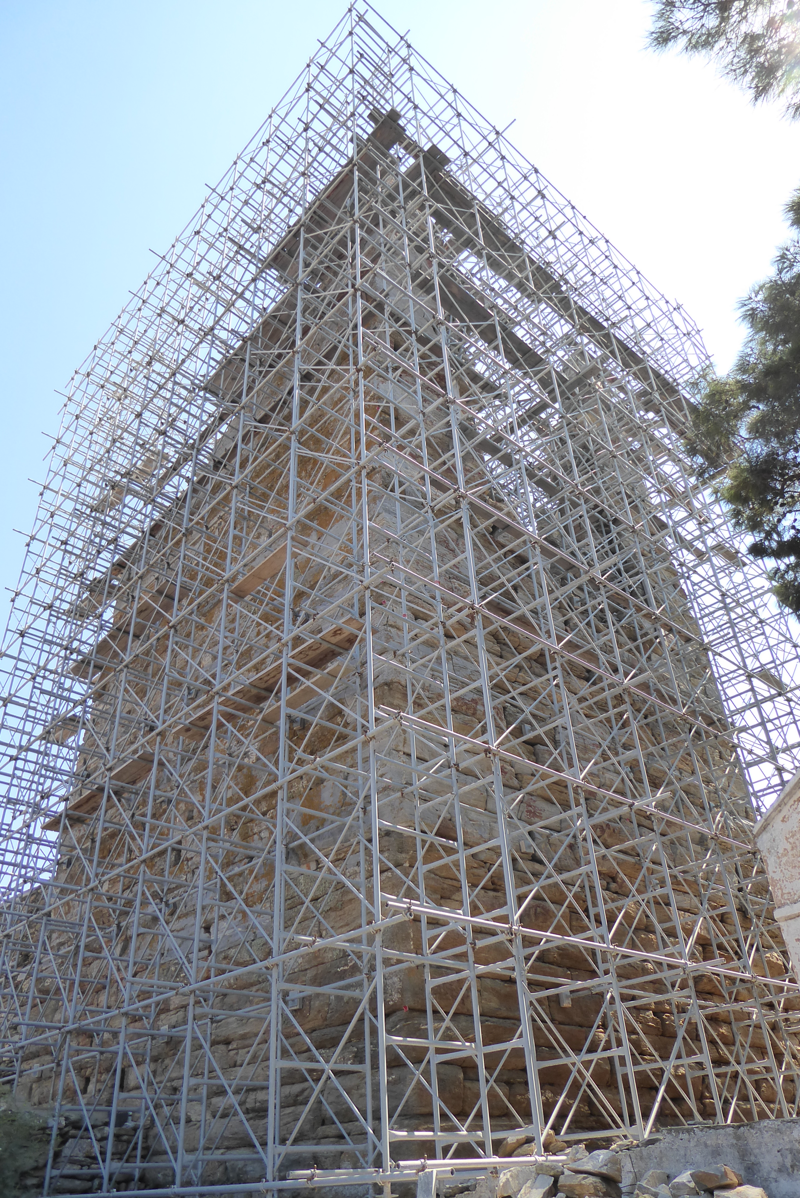
The tower, built in the 4th century BC, still rises to its original height and is the best-preserved example of an ancient square tower in Greece. It was one of the tallest towers in the ancient world and is still one of the highest standing ancient monuments in the Mediterranean region. The building appears to have originally stood alone, but was later incorporated into the Monastery of Agia Marina.
The tower was square, measuring 9.90 x 9.90 metres, and built of local stone (schist and grey dolomitic marble) in irregular trapezoid masonry, with small plaque-like plugs in the gaps. The inside of the tower was laid out on five storeys, which were connected by a stone staircase set into the external tower walls, and divided into smaller rooms. On the fourth storey is a small, isolated balcony on the south side of the building, while on the upper storey a circular balcony supported on stone corbels runs right around the tower. Clearly, Bent’s note about the impending demolition of the balconies in 1884 did not come to pass:
Even now they are contemplating pulling down one of the projecting stones of a balcony, as the old man’s granddaughters fear it may fall on their stove and do some considerable damage.
The tower entrance is on the south side, at a height of 2 metres above the ground. On the south, east and west sides are windows with white marble frames and cornices, while on the north side there were only narrow slits, widening on the inside. It is still uncertain whether the roof was flat or pitched.
The Monastery of Agia Marina was founded around 1600 and the tower was incorporated into it and used for lodging, storage and defence until 1837, when the monastery was abandoned.
When King Otho and Queen Amalia visited in 1840, the tower was still largely intact and the King was able to ascend the internal staircase to the 5th floor where, according to the custodian when Bent visited, he’d had an inscribed stone removed which, allegedly, triggered later collapses. These were compounded in 1858 when part of the tower collapsed as the result of an earthquake.
Mabel’s diary reads:
The tower was perfect 15 years ago but is now half down. King Otho took away some stone, which ruined it.
This must be viewed with some scepticism. The Bents visited in 1884 and Mabel’s account of the guardian’s recollection would put the tower in ‘perfect’ condition in 1869, whereas, we know that a catastrophic collapse occurred in 1858 as a result of the earthquake.
A description of the present-day state of the tower can be found at the Ministry of Culture and Sports website. However, the website has not been updated to reflect the extensive work being carried out to stabilise the tower and reconstruct part of the fallen structure.
As of September 2015, the tower was shrouded in scaffolding and it’s difficult to properly see the structure from outside. The tower itself and the church are closed off for safety reasons. The restoration work is being funded by the European Union and various benefactors. The current phase of funding is expected to run out in December 2015 and the archaeologists involved are uncertain about when, or if, future funding will be available to continue their essential restoration work.
The following picture was taken in 2007 before work began.
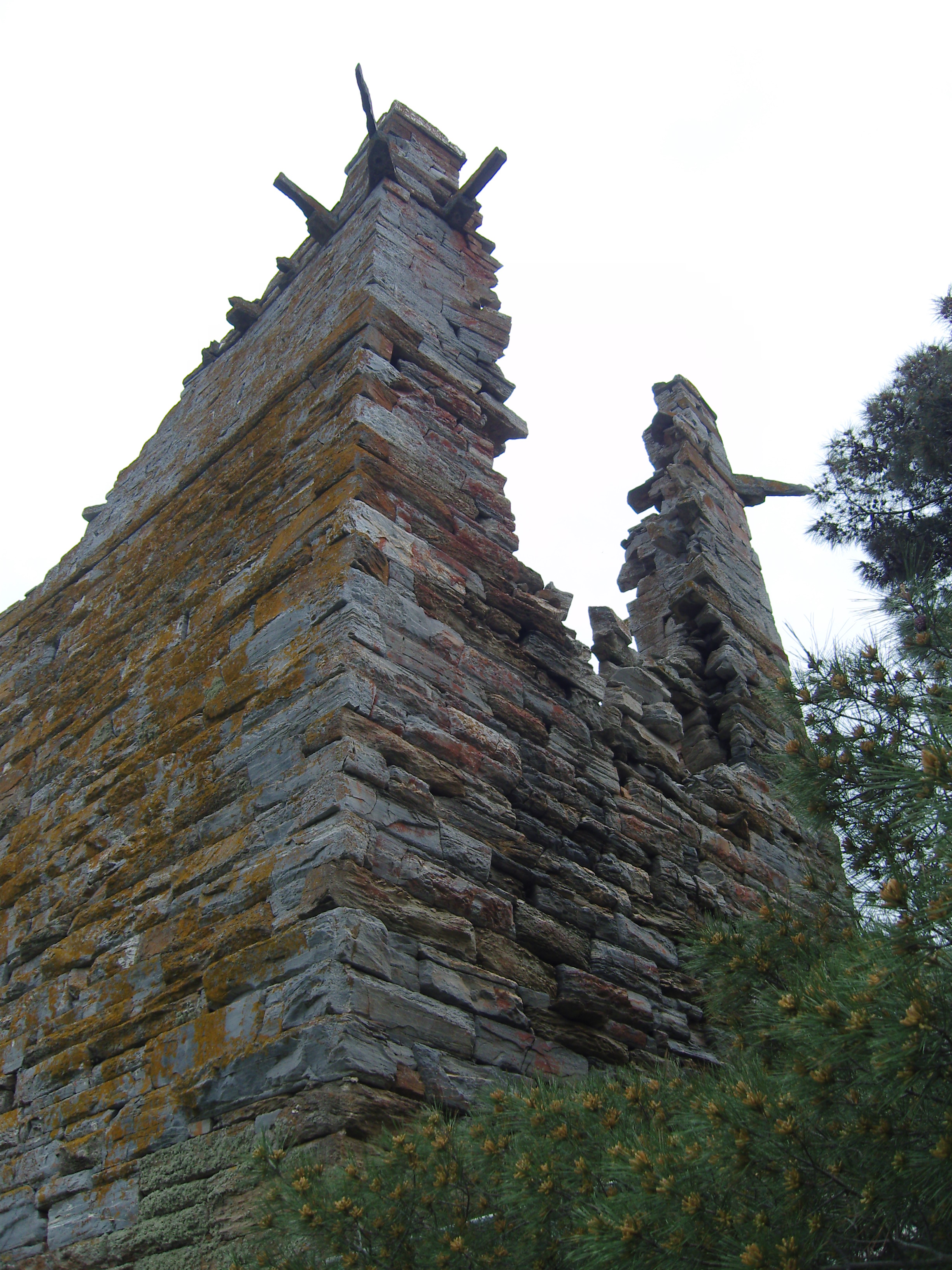
The site is now closed off for the foreseeable future and the tower itself is shrouded in scaffolding to provide support against further collapses.
Otzia – March 31 1884
Theodore and Mabel left Chora to travel north to meet the steamer that would take them to Piraeus. En-route they visited the miltos mines above Otzias where, in ancient times, the red earth had been mined for use as a dye.
About half an hour’s ride below the (miltos) mines is the harbour of Otzia, where there are traces of an ancient mole and of ancient buildings. Doubtless the miltos was shipped from here

Adieu to Keos – March 31 1884
Monday March 31st was the Bents’ last day in Keos, and in the Cyclades, and it sounds as though Mabel was glad to be going home after their 4-month journey.
Mabel’s diary reads:
I gave my shoes a specially good blacking overnight and dressed myself in the best the saddlebags would afford and we started at 7 o’clock on a final expedition, with Barba Manthos in attendance, to some caves 2 hours off to the north where the ancients used to find an earth named miltos, used in red dye. They were very large caves and we had some wall climbing and scrambling to do, and so many thistles. I was sorry I had not my gaiters. We came by a circuit to the port and I felt really excited at the thought of Athens. Our luncheon was stale bread, eggs, and cheese that I could not eat, with sour wine served up on a checked cloth, like dusters, not very clean and some dirty checked dusters as napkins. We decided we should eat something on the steamer. The said steamer was very late, that is 2 or 3 hours late, but we felt so excited about it and the idea of getting back to civilization again. There were many false reports and at last we all embarked and had to sit in small boats for about three quarters of an hour with great joking going on and oh! how glad we were when our old friend the Theséus (ΘΗΣΕΥΣ) came.
Theodore’s account is more positive:
Adieu to Keos — Our last ride in Keos was a deliciously warm and pleasant one down the bed of a torrent full of tall, waving oleanders and carpeted with many-coloured anemones. We passed by the harbour of Otzia and soon reached the primitive harbour, where we met the steamer and bid farewell to Barba Manthos.
Mabel recounts that their hope of eating something on the steamer was dashed:
When we asked for food we were told no cooking would be done on board as all the passengers would eat at the Piraeus, where we did not expect to get till past 7, so we got coffee and retired to a cabin, unpacked all our saddlebags, and cleaned ourselves up to the best of our ability that we might be fit to walk straight in to dinner in Athens if we had the luck to arrive in time . . . we arrived late for dinner.
The Bents would never again visit the islands of the Cyclades, except for Syros while en-route to the Dodecanese.
Join the adventure
Join the adventure – become a contributor to this website and help us track down further information and photographs related to Theodore’s travels in the Cyclades. You can use this website to create a blog post describing your findings and you can upload photographs attached to the blog post.
 Ancient Koressia – March 27 1884

On Theodore’s arrival in Keos he was immediately taken by Barba Manthos to view the ruins of Ancient Koressia.
Barba Manthos, stick in hand, at once took possession of us. ‘You must come with me over the ruins of Koressia first,’ he said, and as Koressia was situated on a spur of hills just over the port I deemed his advice seasonable, and we went
Please blog your findings and photographs of Ancient Koressia so that we can add them to this section.
Hellenika – March 28 1884
Theodore passed through Helleniká on his return from visiting Ancient Karthaia.
On our return journey we passed by the hamlet of Helleniká, which is certainly growing in size, and ought soon to be recognised as a centre for education and modern life. Here are extensive ruins of an ancient Greek village; walls and the foundations of houses are still to be seen
Please blog your photographs and findings of Helleniká, especially of the ruins of the ancient village that Theodore mentions.
Ancient Poiessa – March 29 1884
On the same trip as his visit to the tower of Hagia Marina, Theodore and Barba Manthos rode on further to the site of Ancient Poiessa.
The valley which leads down to the little plain of Poiessa is exceedingly lovely: it is all dotted with the hovels of the landowners, and most of them have large white crosses in whitewash over the doorways to save them, they say, from robbers, who haunt these remote places during the sponge-fishing season
Please blog your findings and photographs of Ancient Poiessa so that we can include them here. Also, any photographs of “the hovels of the landowners, and most of them have large white crosses in whitewash over the doorways” would be interesting.
The Miltos mines – March 31 1884
On their journey to take the steamer from Otzias, Theodore and Mabel visited the miltos mines in the mountains above the village.
The miltos mines are deep holes chiselled in the side of a mountain, about an hour’s ride from the town, to the north of the island, and are known as the ‘caveholes’ by the inhabitants. The chiselled rock has a very bright, rich colour and is strongly impregnated with iron; the marks of the ancient tools are still plain
Please blog your findings and and photographs of the miltos mines described above.